GNSS Setup
This section covers setting up the GNSS receiver before you start. Depending on your requirements, you can set up the receiver using one of the following methods:
Unknown Location - Base & Rover
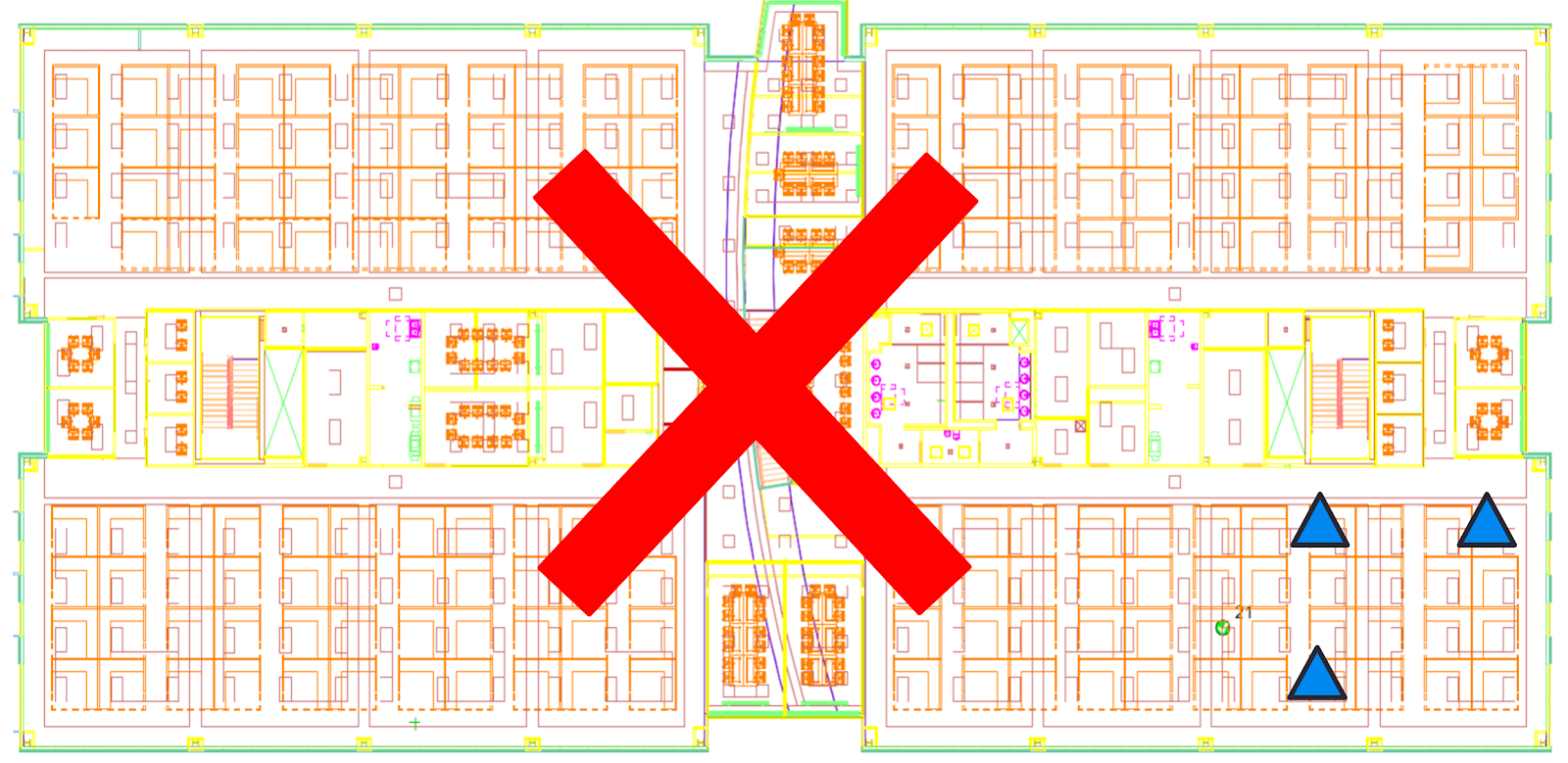
The Base Station can be placed in a convenient location as long as there are at least three control points with a known location in the field of view. It is important to place control points with good geometry balance around the job site.
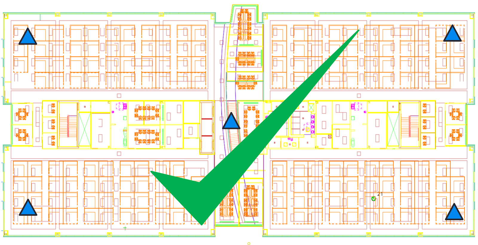
TIP – Avoid setting the control in only one area of the site.
CAUTION – Performing this setup creates a calibration file. If a calibration file existed from a previous setup, the new setup rewrites the old calibration files.
-
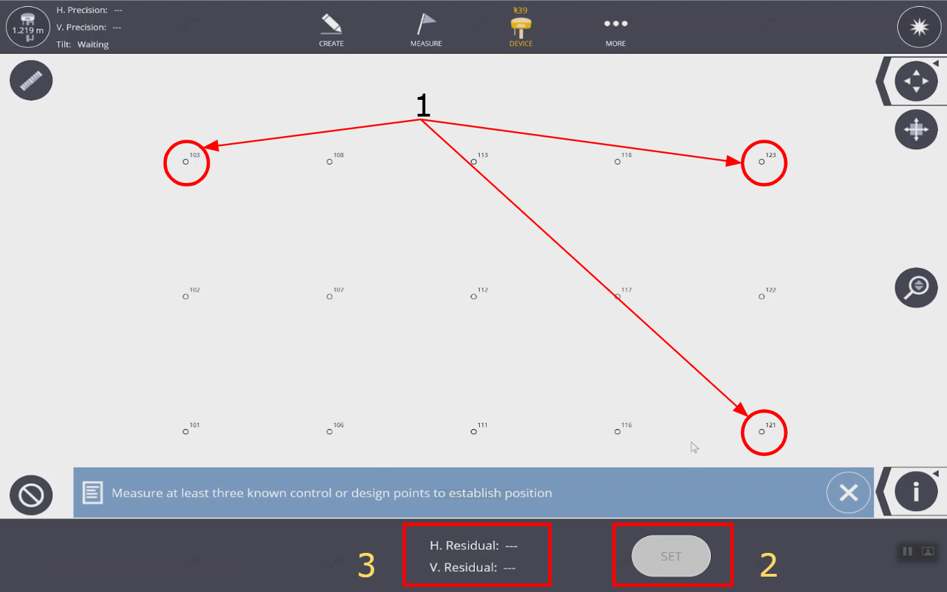
Select a point from the map, set the rover with pole at that location on the job site, and select measure. Repeat step 1 for all three control points.
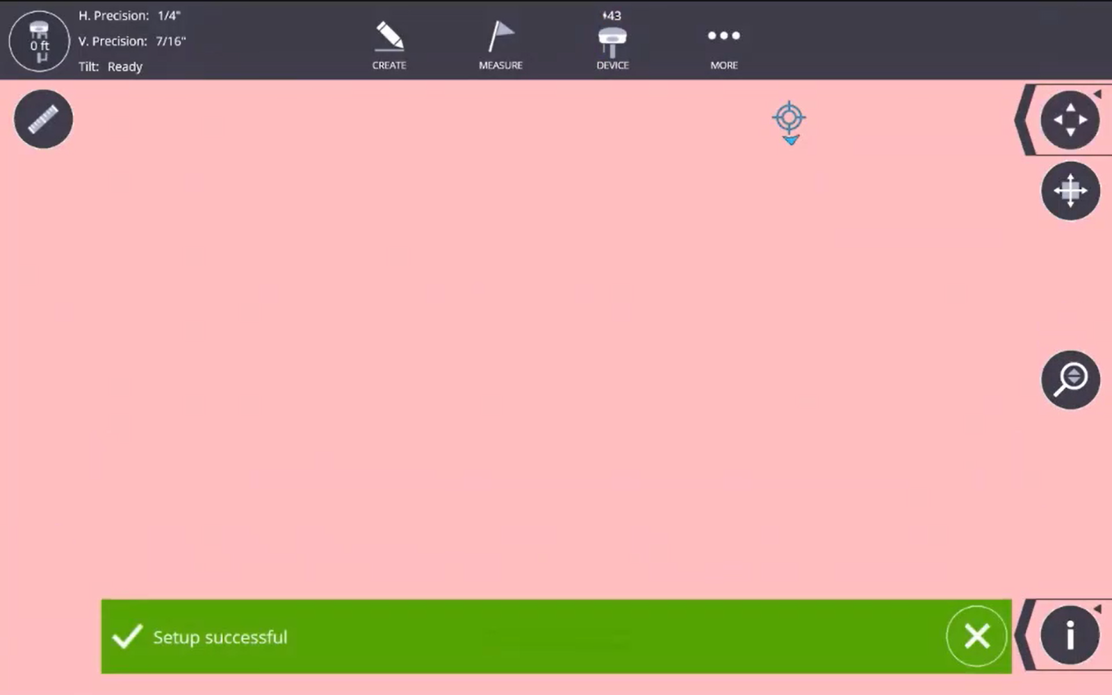
- After you measure all 3 points the horizontal and vertical residuals populate in the bottom taskbar and you can tap the Set button. To create a point where the base is located, tap Store Base Location.
-
The Setup Successful toast appears.

Known Location - Base & Rover
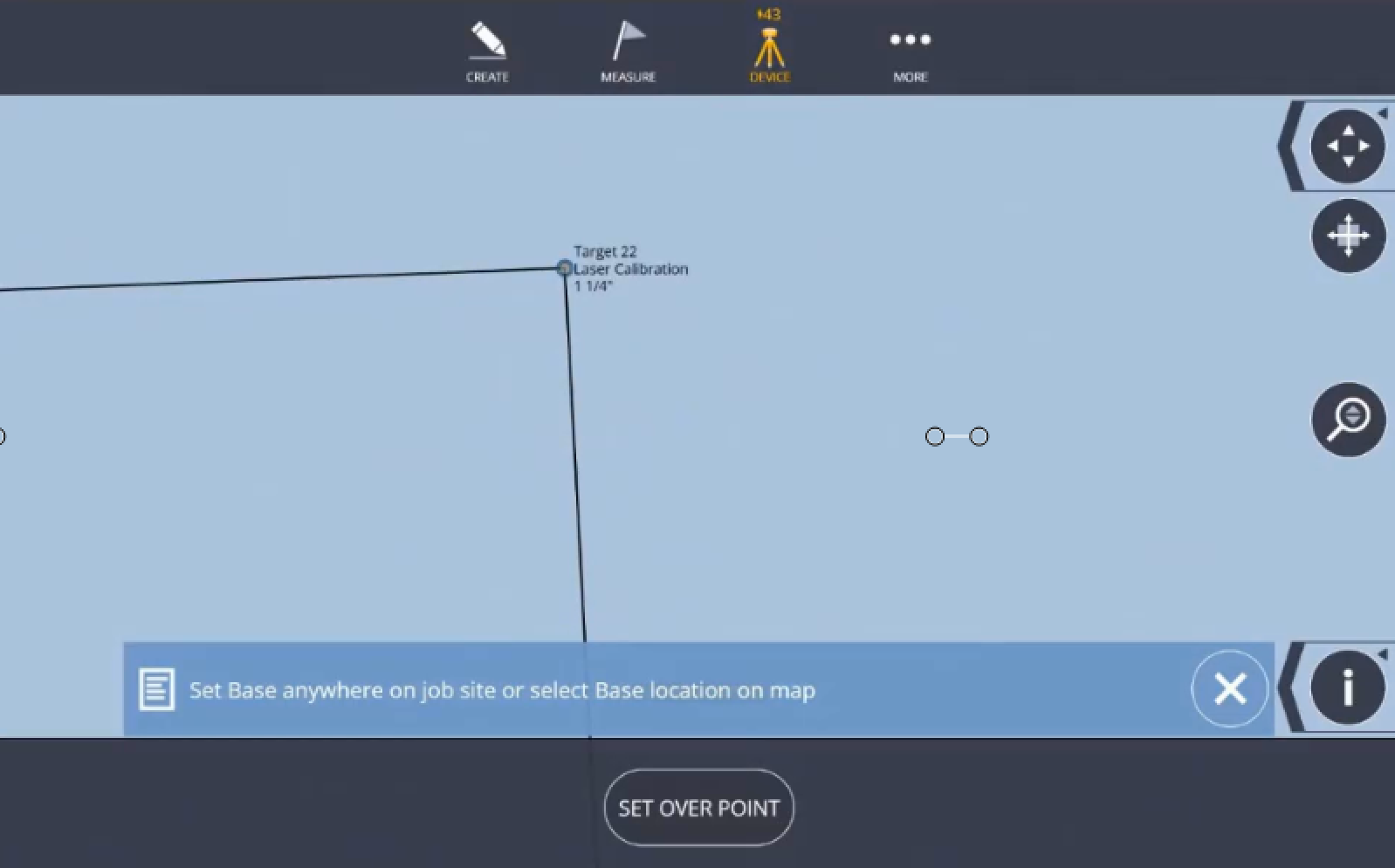
On the jobsite, it may be convenient to setup the base station on a known point to conduct your layout. It is recommended to verify the quality of the set up by shooting another known reference point before layout. Use the following procedure to complete the known point setup.
-
Tap base point location on map.
-
Tap Set Over Point.
-
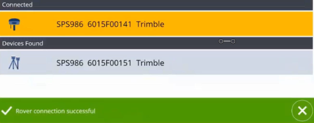
Once Base Station in established, tap Find Rover.

-
Tap Rover and wait to see the Rover connection successful.
-
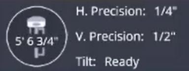
Once the Rover is connected and receives corrections, GPS precision will be in tolerance.

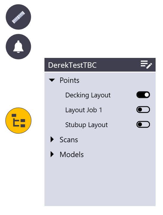
No Data in the Job
Can be performed in a job with no imported points or model data.
-
Tap More
 and then tap Projects.
 -
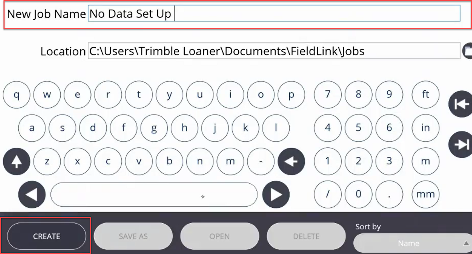
Tap Manage and then tap Create.
-
Name the job and then tap Create.
-
Tap Device
 and then tap Set Up.
-
Steady the receiver and select Measure to complete setup. To create a point where the base is located, tap Store Base Location.
GNSS Set Up - VRS/RTK
VRS is a correction service for GNSS workflows. VRS gives access to RTK correction services using a network of permanent, continuously operating reference stations. (Strong LTE connection required for reliable VRS use).
Once you are licensed with a VRS Subscription, enter your subscription credentials in FieldLink under the Device Settings VRS Menu. Once the credentials are received the closest mountpoint to use for the correction service is selected in the drop down list.
To determine the proper mount point to use, please refer to your project manager for this information.
GNSS Set Up - RTX
RTX is a correction service for GNSS workflows. RTX only requires satellite signals for positioning, making it the easier, more accessible GNSS workflow.
Once the GNSS receiver is licensed with an RTX license, a coordinate system MUST be assigned to the project for you to be able to use the RTX correction option.
NOTE – RTX option is available for a local setup or by selecting a Coordinate System for the Project.
When you open a project that has RTX set as the correction method, you must wait until satellite convergence. Once convergence is reached (the receiver has obtained its location within accuracy parameters) you can continue.
Retain Station Setup
If you have performed a station setup (total Station, GNSS or scanner setup), you can retain that setup and the control points used for the setup when changing jobs within one project. This means you can navigate efficiently between layout jobs in one project without having to re-setup the instrument.