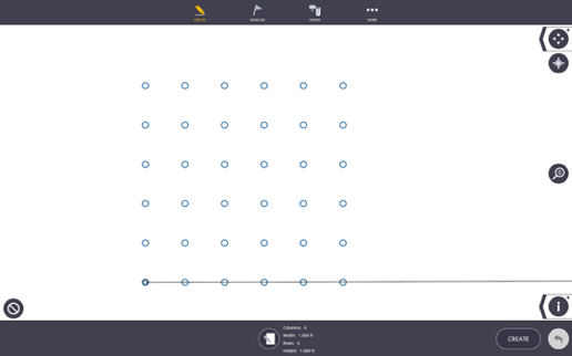
Grid
In the Grid work mode, you can create points on a specified grid pattern with defined point names, descriptions and layers.
- Tap the Create icon
 and then tap Grid.
 - Tap the Input Form icon
 .
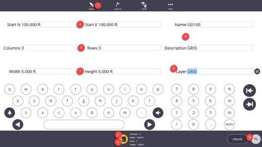
. - Input the values for each of the fields. The Start N(X) and Start E(Y) will position the first grid point at that location and defaults to 100(X), 100(Y), or select the starting point from the map view.
- Input the Point Name and Description.
- Input the number of grid Columns and Rows.
- Input the Width (distance between the grid Columns), and the Height (distance between the grid Rows).
- Place the points on a specific layer by tapping the Layer drop-down menu, or type in a new layer to create a new layer name.
- Tap the Input Form icon again to view the points on the map view before creation if desired.
- Tap Create to finalize the grid points.
- To modify the values or undo the creation, tap the Undo Arrow.
- Use the Map Controls icons including the Zoom Extents, Zoom Slider Bar, Point Information, Map Settings and Layer icons to isolate an area or layer for viewing, or to show the point layer, description, and elevation information.