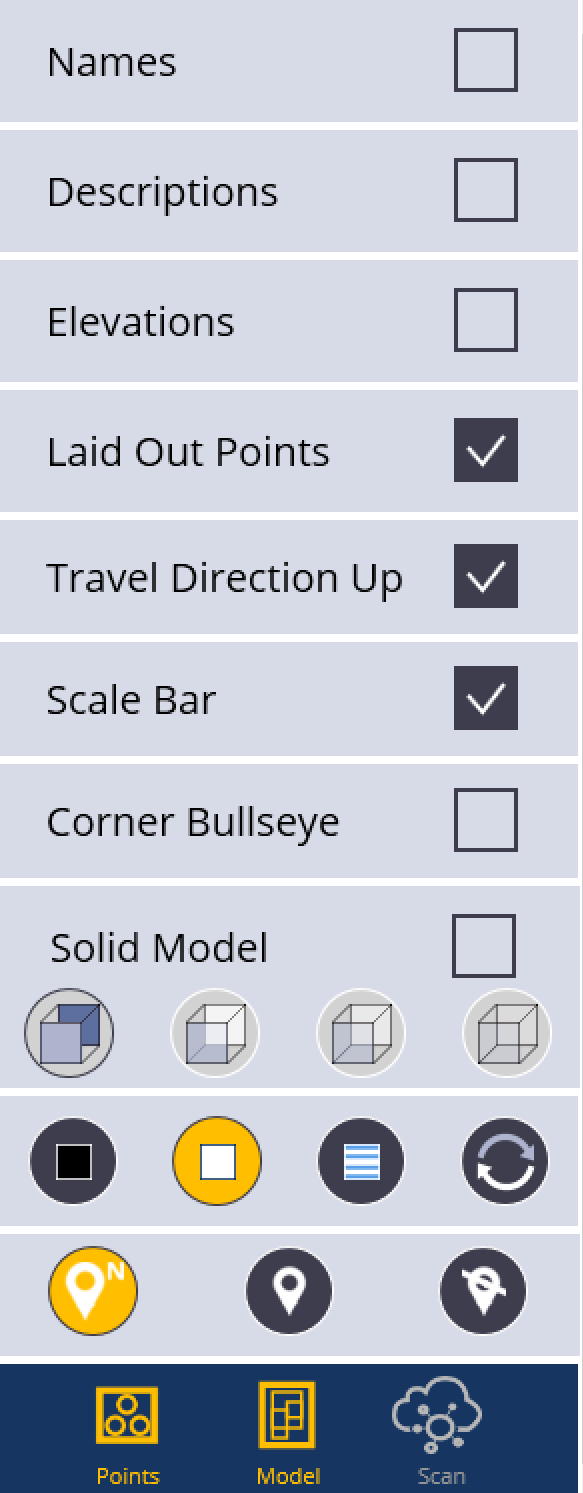
Map Settings
Tap the Information icon ![]() and then tap the Map Settings
and then tap the Map Settings ![]() icon to make point information such as Name, Description or Elevation visible on the screen.
icon to make point information such as Name, Description or Elevation visible on the screen.
The Map Settings panel includes the following options:
-
Laid Out Points: Clear this check box to remove points from view once they have been laid out.
-
Travel Direction Up: Select this check box to set the travel direction to up in layout mode.
-
Scale Bar: Select this check box to add a scale bar to the map.
-
Corner Bullseye: Select this check box to use corner bullseye mode.
-
Solid Model: Select this check box to view solid models. Clear this check box to view wireframe models.
You can also change the background color to white or black or you can make all linework blue for better visibility in certain conditions.
Map Display Options
- Tap the Arrow next to the Information icon
 .
. - Tap the Map Settings icon
 .
. - Make selections to display Point Name, Point Description, Point Elevation, Laid Out Points (If unselected, points will disappear off the screen once they have been laid out), Travel Direction Up (map rotates and updates as you walk to the point - Blue Diamond indicates travel direction), Scale Bar, and Corner Bullseye (Shows a corner bullseye option and full map screen while laying out points, lines or arcs).
- You can also change from Wireframe to Solid Model, and various levels of transparency for the solid models.
- Change the Background Color to Black, White, White with all blue line work, or the arrow button to cycle between various other color backgrounds.
- The Points and Model icons allow you to toggle these options on or off. Yellow being on, white being off.
- To close the menu, tap the Map Settings icon .
