Export Stations
Stations are exported in a folder named according to the project name followed by the export format. As for the export of a project, if the station has a high quality panorama, Perspective exports the high quality panorama as a 360° image in JPEG format in a specific folder (HQ Panorama Images), and the registration information (location and orientation) of the high quality panorama in a CSV format file with the following information:
-
Name of the JPG station panoramic images.
-
Location expressed with X,Y,Z coordinates in meters (International System of Unit).
-
Orientation using the center of the image as reference and expressed as a quaternion (qx, qy, qz, qw).
-
Tap
 to open the Stations List panel.
 -
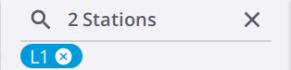
(Optional), filter the stations by name(s) or by label(s):
-
Tap
 to open the Search field in the Stations List panel.
 -
Filter the stations by name.

-
Type the station names separated by commas (e.g. 1, 3, 8) and (or) station ranges separated counting from the start of the station or the selection (e.g. 5-8).
To make the station names easy to read, you can put a space before and after a comma.
-
Type
(or Enter).Filtered stations remain displayed, and you can add new ones to filter.
Tap
 to switch to the label filtering and to clear the filtering.
 -
-
Or filter the stations by label(s):

-
Enter a label name and type Enter.
-
Or select a label from the drop-down list (if any).
-
Or select a label from the list of labels (if any) for a station.
Tap
 to switch to the station filtering and to clear the filtering.
 -
-
Tap
 to close the Search field.
You delete a label filtering by removing it.
-
-
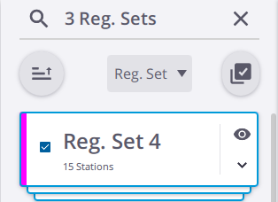
Select a set of stations:
-
Tap
 to open the Stations Selection tool. If no filter has been applied, all stations in the project are displayed. If a filter has been applied, only the filtered stations (either by name(s) or by label(s)) are displayed. In the Reg. Set. display mode, a Reg. Set. with no filtered station(s) is not displayed.
-
Tap a station card to select the station. Tap again the station card to deselect the station.
-
Tap
 to select all the filtered stations. Tap again to deselect the selected stations.
You can select a registration set and export all the stations of the set.
-
-
(Optional), tap
 to delete the selected station(s).
Selecting all stations in the project to export is similar to exporting the whole project (see Export a Project). The project has to have at least two stations.
-
-
Tap
 Export:
-
(Optional), if some stations have been selected, choose Colorize Point Clouds and Create High Quality Panorama.
-
(Optional), if all stations of the project have been selected, in addition to the options above, choose Refine Project and/or Georeference.
-
(Optional), choose Export Annotations (.csv) if there are some annotations and/or precision points in the selected stations.
-
Choose:
-
Local to export the selected stations locally on your device. Tap
 to choose the export path, and
  to choose the appropriate format to export to (see Export a Project for the available formats).
 -
Cloud to export the selected stations to Trimble Connect (see Export to TRCPS).
-
-
-
Tap
to close the Stations Selection tool.
-
Do one of the following:
-
Tap
 in the Map View to display the pop-up menu.
 -
Tap
to open the Stations List panel:-
Expand a station card and tap
 Details.
 -
Or tap
to open the Stations Selection tool, and select a station.
-
-
-
Tap
Export:-
(Optional), choose Colorize Point Clouds and Create High Quality Panorama.
-
(Optional), choose Export Annotations (.csv) if there are some annotations and/or precision points in the selected station.
-
Choose:
-
Local to export the selected station locally on your device. Tap
to choose the export path, and to choose the appropriate format to export to (see Export a Project for the available formats). -
Cloud to export the selected stations to Trimble Connect (see Export to TRCPS).
-
-
-
Tap Export.
