Measurement Tool
The  Measurement Tool lets you measure the 3D position of a point, a distance between two points, or an area and perimeter drawn by several points. These points need to be picked on the scan data in any view (Map View, Station View and 3D View).
 Single Point Measurement lets you measure the 3D position of a point on the scan data. Tap a point in any view. The distance from the scanner origin to the measured point is displayed when you are in the Station View:
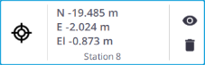
A (Slope) Distance
The
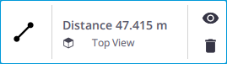
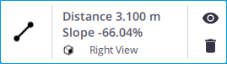
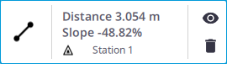
(Slope) Distance Measurement lets you measure the distance between two points and the resulting slope in percentage. Tap two points:
In the Map View, in Top View to measure the distance.
In the Map View, in Front View, or Right View to measure the slope distance.
In the Station View to measure the slope distance.
In the 3D View to measure a slope distance.
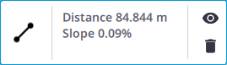
A slope percentage can be positive or negative, depending on the order of the points picked on the slope.
The
Horizontal Clearance Measurement lets you measure a 2D distance in the X Y plane (or North East plane). Tap two points in the Station View.
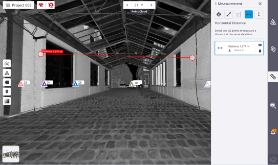
The measurement is performed between the first point and the projection of the second point in the X Y plane (or North East plane).
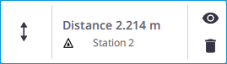
The
Vertical Clearance Measurement lets you measure a 2D distance along the Z axis (or the Elevation axis). Tap two points in the Station View.
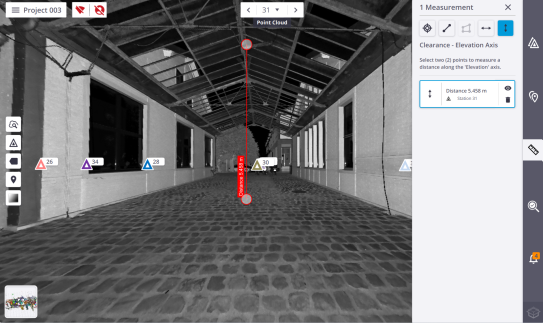
The measurement is performed between the first point and the projection of the second point along the Z axis (or the Elevation axis).
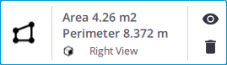
The
Area Measurement lets you measure an area and a perimeter. Tap at least three points in the Map View.
The results display in any view and are stacked by measuring order in the Measurements panel. The following information is included where applicable:
-
The station inside which the measurement has been done.
-
The view from which the measurement has been done.
Tap  (or
(or  ) to display (or hide) a measurement.
A measurement in progress (or a selected measurement) is highlighted in red in the viewers, and its card is surrounded by a blue frame.
Select a measurement in a view. The selected measurement displays in red in the view and is surrounded by a blue frame in the Measurements panel. Tap .
.
Select a measurement in a view. The selected measurement displays in red in the view and is surrounded by a blue frame in the Measurements panel. Drag and drop a point in the Map View (or Station View) to update the measurement.
The software automatically saves the measurement results to the project. These results will be:
- Reloaded (by tapping ) when reloading the project.
- Exported with the project when exporting to the TDX format. See Export a Project.
