Capturing data with the Trimble TerraFlex software
Trimble TerraFlex® software provides a GIS data capture workflow to capture new data or update an existing GIS database. Using Trimble Connect Maps this workflow integrates seamlessly with SiteVision for accurate visualization of the captured data.
When capturing new data in TerraFlex, you can define a template in Trimble Connect Maps to collect all the required attribute information. These attributes can in turn be used to drive SiteVision visualization rules .
Using SiteVision to review data captured or updated with TerraFlex is a great way to perform quality assurance checks on updates to your GIS system.
 Creating and capturing data with TerraFlex
-
Start by creating a Project template and forms in Trimble Maps workspace
-
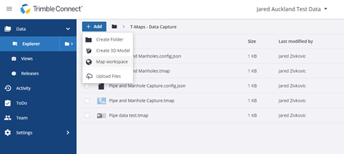
Start a Trimble Connect Project.
-
Create a Map Workspace.
-
Name and add a description to your new Map Workspace.
-
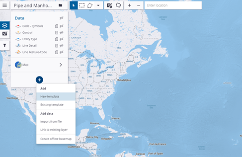
From the menu click + then New Template.
-
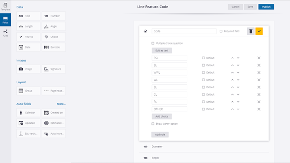
Change the lines to be Lines Feature-Code.

-
Include fields in the template: Attribute Name and Value.
-
Click Publish to save your template.
Use TerraFlex and the project template you created above to collect data.
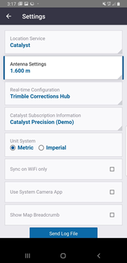
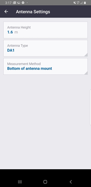
NOTE –When using TerraFlex with a connected antenna, you can set the antenna height in the Settings menu. This is important as TerraFlex captures 3D data and an incorrect antenna height could result in incorrect elevations that will become apparent during a SiteVision visualization.
-
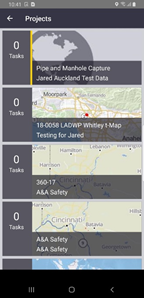
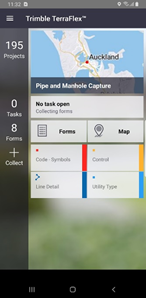
Open TerraFlex, tap Projects and navigate to your project to load it.
-
Identify and move to the data points you want to collect.
-
Tap
 .
.
-
Select your form.
-
Collect your position data:
-
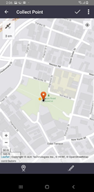
Point data is collected automatically. To edit a point, tap the Point field next to the GNSS accuracy, then in the map that displays, use one of the collection methods to collect the point at your location. Tap
 to save the captured data.
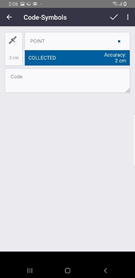
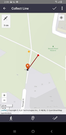
-
To collect line data, tap the Line field to bring up a map, then collect data using one of the collection options. Tap
to save the captured data.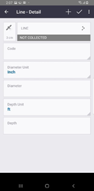
-
-
Fill in the required fields, then tap
to save the data. -
Repeat as need to collect all the required data.
-
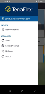
When all the required data is collected, tap the menu icon then tap Sync.
Updating existing Trimble Map Workspace data using the TerraFlex software
-
Open TerraFlex, tap Projects and navigate to your project to load it.
-
Use the map to find your data location.
-
Click the Forms tab then select the form you want to edit. Tap
 .
. -
Collect your position data:
-
Point data is collected automatically. To edit a point, tap the Point field next to the GNSS accuracy, then in the map that displays, use one of the collection methods to collect the point at your location. Tap
to save the captured data. -
To collect line data, tap the Line field to bring up a map, then collect data using one of the collection options. Tap
to save the captured data.
-
-
Fill in the required fields, then tap
to save the data. -
Repeat as need to collect all the required data.
-
When all the required data is collected, tap the menu icon then tap Sync.
Viewing your TerraFlex data in SiteVision
When you have created, edited, or updated your data as required with the TerraFlex software, you can view it in SiteVision.
-
Sync your TerraFlex project.
-
Close TerraFlex fully on your device.
-
Open Trimble SiteVision.
-
Select Load Model.
-
Navigate to your project then to your Trimble Map Workspace.
-
Load the project.
-
Use SiteVision to navigate to and visualize your data.
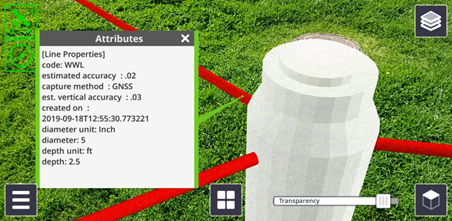
The data shows any attributes recorded and applies symbols from your rules file (if applicable).
