Map Options: Layers tab
Use the Layers tab to turn individual or all layers on and off in the design map to improve readability if there is a lot of data in the linework of the current design file. From version 1.72, there is a more robust layer visibility manager available from the main plan and cross section view screens by tapping the ![]() icon in the map controls toolbar.
icon in the map controls toolbar.
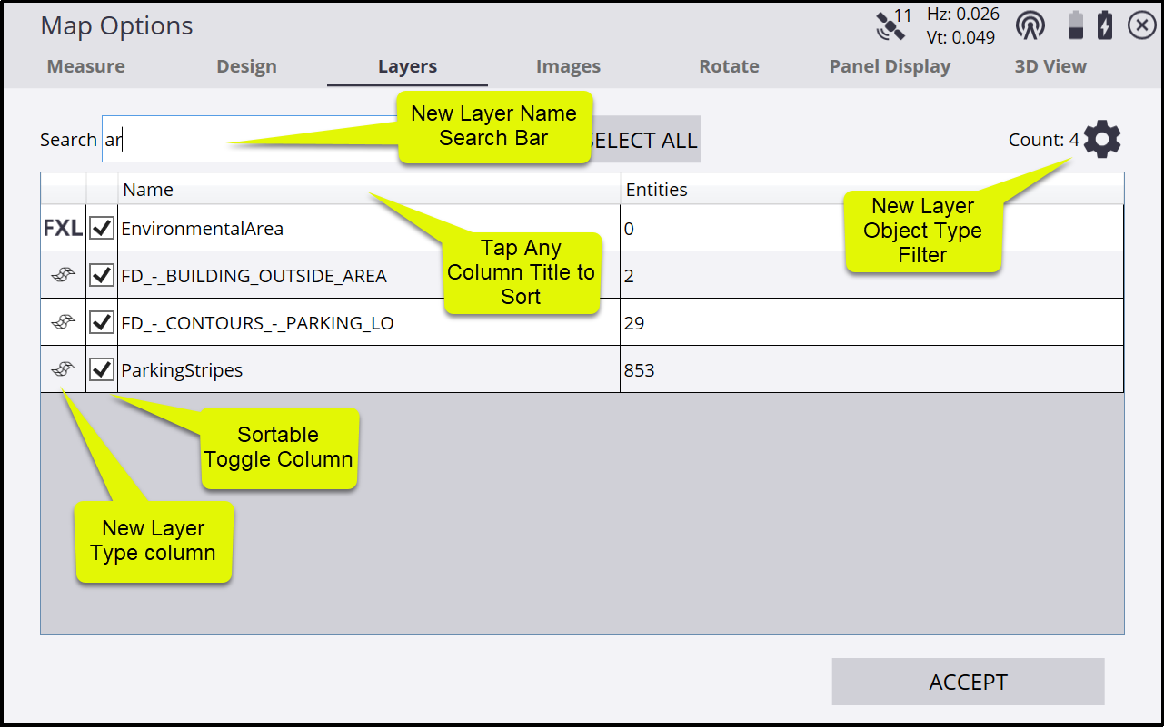
Use the Search bar to find layers by name. Typing in this field filters the list to those layer names that match any portion of text entered into the search window. For example, entering “AR” will filter to display any layer names containing those letters such as “Area” or “Parking”. The filter is not case sensitive.
To toggle on and off individual layers, select or clear the check box next to their names.
To toggle on and off all layers, tap Select/Unselect All Layers at the top of the screen.
To change the width of the columns, tap and drag on the divider in the top title row.
Tap the Name or Items or checkbox column title to sort the columns.
Tap ![]() in the upper right to open a filter option to filter on layer object type. The filter options include Siteworks Measured Data, Siteworks Stakeout Data, Design Layers, FXL Layers, and Layers with no data.
in the upper right to open a filter option to filter on layer object type. The filter options include Siteworks Measured Data, Siteworks Stakeout Data, Design Layers, FXL Layers, and Layers with no data.
-
Design Layers are those layers that are present in the currently loaded DXF, DWG, or VCL design file.
-
FXL layers are those layers in the Project’s FXL file or created in Siteworks (available for users with the Advanced Measurement Module)
-
Layers with no data are those layers that do not contain any objects.
-
The Count will be updated to display the number of layers displayed in the table. Note that these checkbox options do not turn the respective layers off or on in the map view, they only control if they are displayed in the layer table screen where they can then be toggled off or on.
The search bar, layer object type filter and sortable checkbox column were introduced with version 1.72 are not available in previous versions.
A more fully featured layer manager has been added to Siteworks version 1.72 that is accessible from the main plan view map, cross section and profile views. Tap on the Layer Manager icon ![]() in the right side map toolbar to open the new Map Layer Visibility split screen:
in the right side map toolbar to open the new Map Layer Visibility split screen:
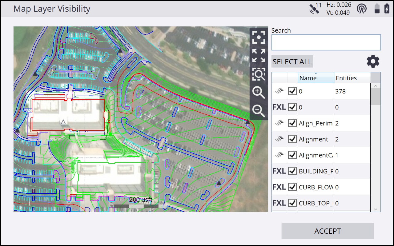
This screen enables you to toggle measured and design layers in a searchable, sortable, and filterable list on the right side, where the layer display will update in real time in the preview map window on the left. Please see the descriptions below for the details of the new search bar, toggle column, and layer object type filter.
The original existing Layers tab of the Map Options, accessed through the Map Options ![]() icon on the main map screen is not a split screen, like the new Map Layer Visibility window, although it does contain the new search, filter, and toggle columns.
icon on the main map screen is not a split screen, like the new Map Layer Visibility window, although it does contain the new search, filter, and toggle columns.
