Precision GNSS control icons
When using the internal GNSS or while connected to an external SPS receiver, an icon panel appears at the top right of the screen.
GNSS mode
|
This icon… |
shows… |
|---|---|
|
|
how many satellites are being tracked and the horizontal and vertical precision of the GNSS position solution. |
|
|
the radio connection status. |
|
|
the battery level of the controller and GNSS receiver. |
Tap one of these icons to show more detailed information. To access the sky plot of the current satellite constellation, tap the Satellite or the Precisions icon. The screen defaults to the GNSS Status sky plot view. The current Position, Horizontal, and Vertical Dilutions of Precision (DOP) values are also displayed, in addition to the position status, number of satellites used in the solution, and the alignment status of tilt-compensated receivers.
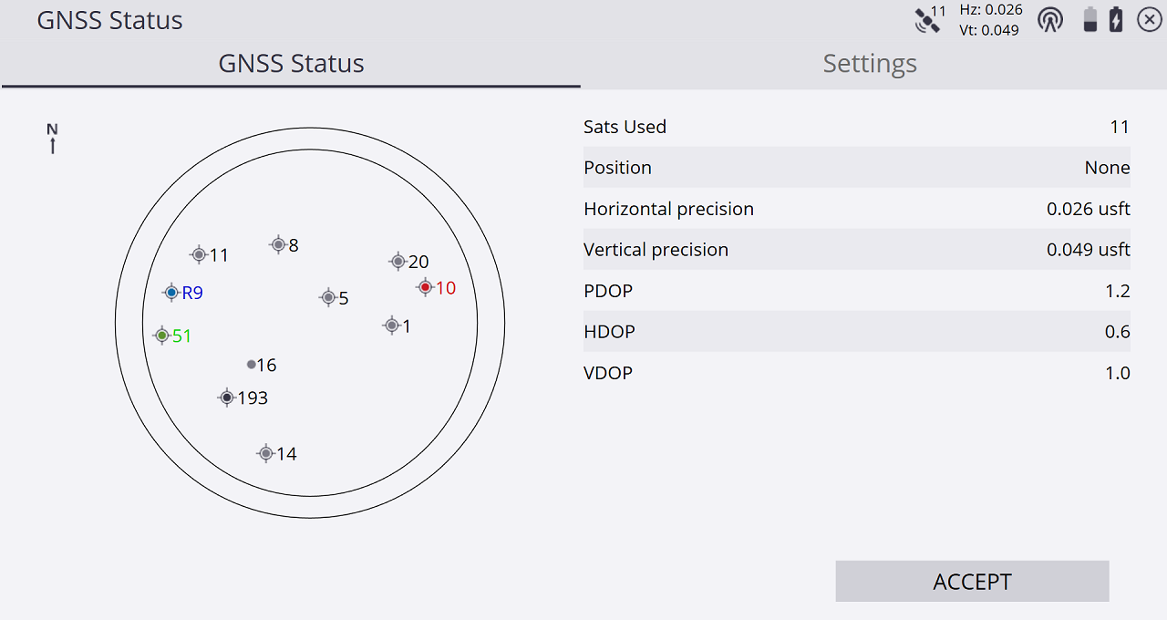
The icons in the sky plot represent the following satellite constellations:
|
This icon… |
shows… |
|---|---|
|
|
GPS |
|
|
BeiDou |
|
|
Galileo |
|
|
GLONASS |
|
|
QZSS |
|
|
SBAS |
|
|
Satellite not used in position |
The Settings tab is a shortcut to the RTK Precision and other GNSS settings options. If the precisions of the GNSS rise above these values, the info bars flash red and a warning pops-up if a measurement is attempted. The GPS Only checkbox enables you to toggle between using GPS and GNSS satellite constellations. A toggle for the receiver’s Wi-Fi is present, along with the ability to enable or disable tilt-compensation for compatible receivers. If the receiver is equipped with Wi-Fi, you can toggle that here, for example to connect to the receiver through the web interface. Also, if connected to a tilt compensation capable GNSS receiver that can be turned off or on. Additionally, you can enter the Plumb Pole Routine to calibrate the tilt compensation enabled receiver to the survey pole by tapping the Plumb Pole Routine button.
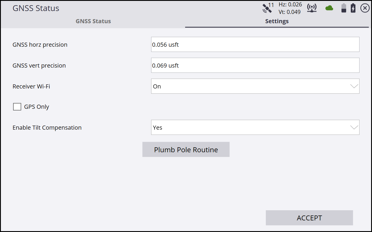
While in the GNS Status screen, you can set the elevation mask of the GNSS rover receiver by pressing Ctrl+M on the controller’s keyboard. Note that you must use the virtual Windows keyboard on a T7, T10, or Site Tablet 10 to access the Ctrl key. The rover’s elevation mask setting will also govern the elevation mask used for the satellites received from a base station, as the rover will ignore all satellite data from the base for those satellites below the mask elevation value set on the rover.
Tap the Radio icon to open the Radio Information screen, where you can view information about the model of the radio, its current channel, the base name, and reception information. You can change the radio channel in this screen.
