EZ Level measurement
This feature provides a simple and easy way to graphically display elevations on a site relative to an arbitrary benchmark that is measured as part of the EZ Level workflow. This is a display and indicate-only feature and does not store any points or measurements. It is available for both GNSS and total stations. It does not require a site to be calibrated for GNSS use, or a total station to be set up on a known point. The intent of this feature is to provide a laser level-like workflow to quickly and accurately determine cut/fill values from an arbitrary EZ Level elevation relative to a measured benchmark elevation.
To open the EZ Level feature, tap the Measure Mode icon on the right side of the main panel:
![]()
Alternatively, tap the Home menu and then tap Measure and select EZ Level:

The EZ Level Settings screen appears. Enter a benchmark elevation which is the reference elevation that you wish to measure. Enter an arbitrary value for the benchmark elevation or select the elevation of a control point from a list of control points by tapping the list icon: ![]()
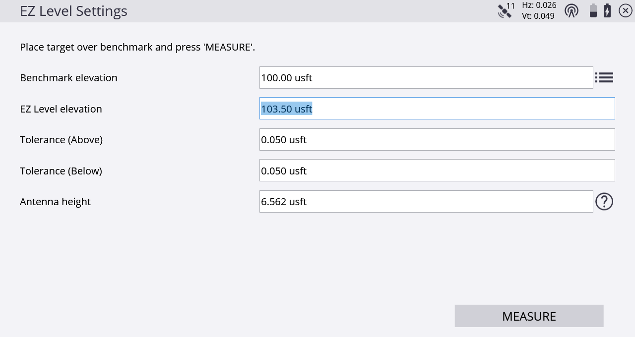
The EZ Level elevation is the elevation value that is used to display the cut/fill values to on the EZ Level screen and is relative to the arbitrary benchmark elevation. For example, if there is a benchmark at elevation 100, and you want to determine cut/fill values for a finished floor elevation of 103.5, you would place the rod on the benchmark at 100, enter 103.5 for the EZ Level Elevation, and then measure the benchmark. On-screen values then indicate the cut/fill relative to the 103.5 EZ Level elevation. The current elevation is displayed in the center of the screen, between the two arrows, and the cut/fill values to get to the EZ Level elevation are displayed on the upper or lower arrows respectively.
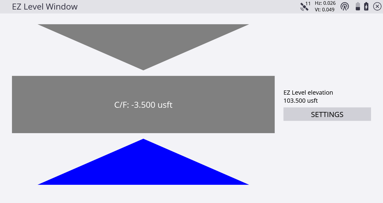
To re-enter the settings window to change the EZ Level elevation and/or measure a new benchmark elevation, tap SETTINGS.
