Measuring with feature codes
The Advanced Measurement module is required to use a Feature Code library.
The software can use feature codes to record data on site. Create and customize the feature code library using the Feature Definition Manager of the Trimble Business Center software. Feature codes are stored in a Feature Code Library .FXL file. The FXL file is located in the main Project directory. It is possible to select a FXL file when creating a new project, assigning one to a project in WorksManager, or by simply placing a FXL file in the Project directory.
The feature code defines if a point, line, or breakline is measured. The following classes of feature codes are available:
|
Feature code class |
Definition |
|---|---|
|
|
Point feature, but no surface feature. |
|
|
Line feature, but no surface feature. |
|
|
Point feature and surface point. |
|
|
Line feature and breakline. |
|
|
Feature contains optional or compulsory attributes. |
The currently selected feature code and its class can be identified in the info bar/panel when the FXL code option is checked. To select and manage feature codes in the field, tap ![]() on the main panel to slide out a quick access toolbar. Tap the FXL Settings icon
on the main panel to slide out a quick access toolbar. Tap the FXL Settings icon ![]() to open the FXL code matrix.
to open the FXL code matrix.
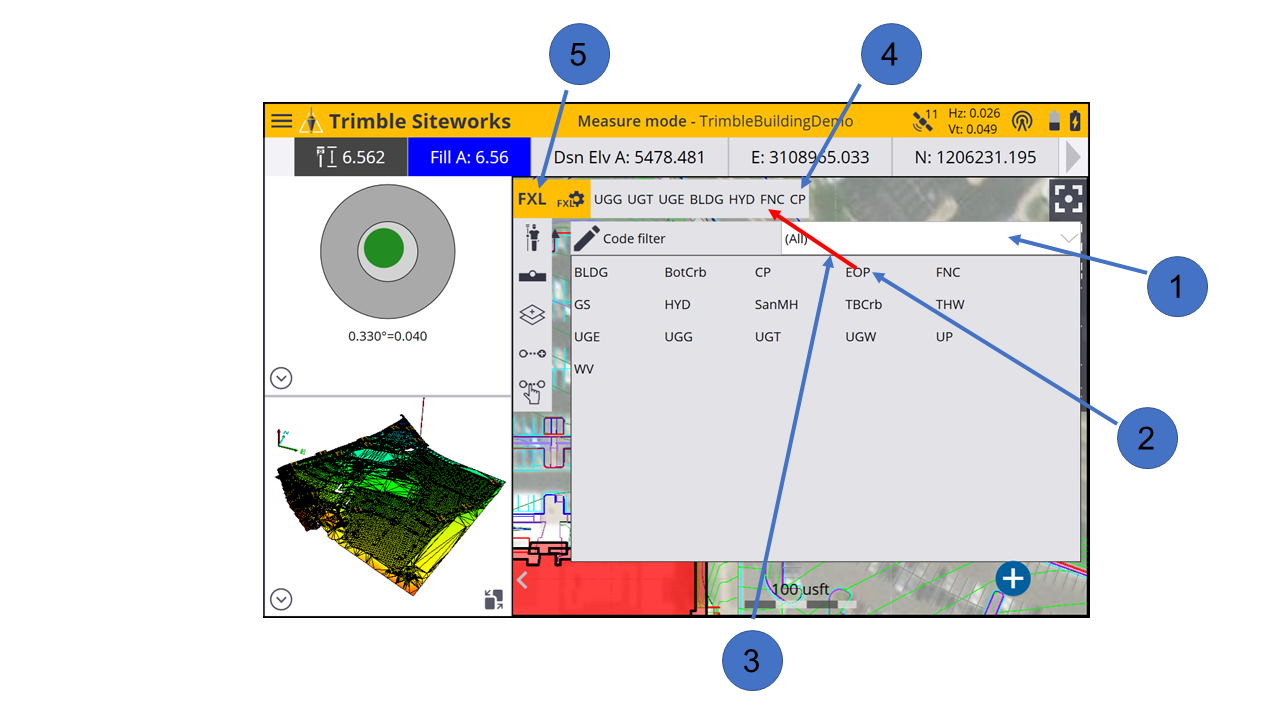
|
Select this option… |
to… |
|---|---|
|
① |
filter by group or category. |
|
② |
select a feature code. |
|
③ |
drag code to the Quick Select list. |
|
④ |
select from the Quick Select list. |
|
⑤ |
toggle to the Grid view. |
To select a feature code, either tap on one of the buttons in the Quick Select list or select a feature code from the Grid view. The Grid view enables you to measure data without seeing the map. Instead you have up to 34 codes to choose from with a single tap.
Both the Grid view and the Quick Select list selection enable you access feature codes quicker by filtering feature codes by group and category. Groups and categories must be defined in the Feature Definition Manager in the office.
A category is a class of related feature codes, for example, vegetation. For certain measurements or tasks, you might want to group feature codes from different categories into a group for faster access.
With each feature code, different attributes can be stored, which enables you to describe a recorded point or line with more information. Attributes need to be set up in the Feature Definition Manager and cannot be changed or created in the field.
Different properties can be applied to each attribute, for example, if it is optional or compulsory to fill out this attribute, which values are required for this attribute, the permitted length of the text string that you can enter, or available items in a dropdown list.
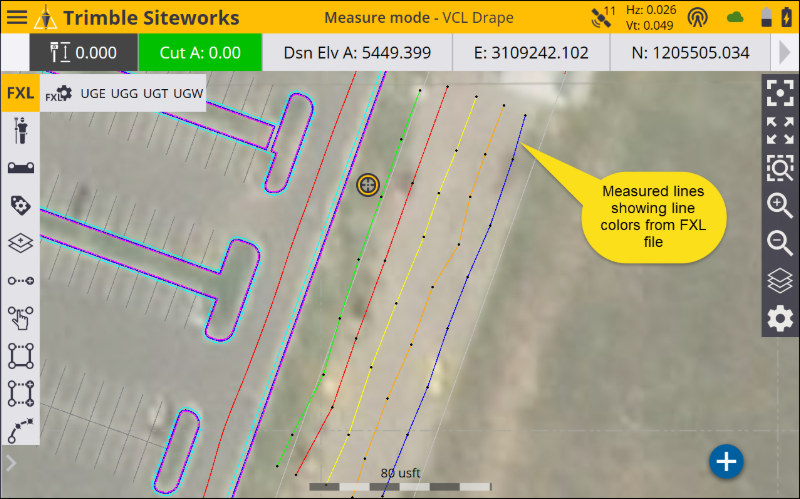
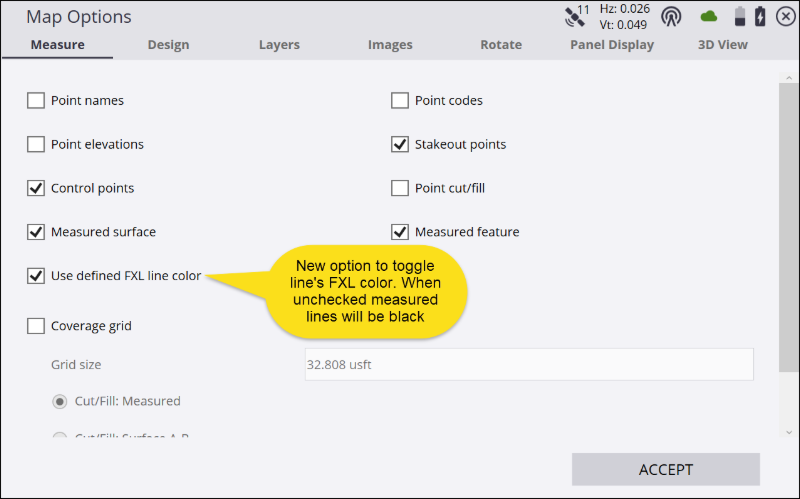
Siteworks v1.75 and later displays the line color defined in the FXL code of measured lines on the main map screen. In the measure settings window an option called Use Defined FXL Color has been added. When this option is selected, the measured lines display in the FXL color; when not selected the lines are black. Lines are still shown as a thick red line when they are being measured. Lines assigned a white color are displayed in black. Line styles, e.g. dashes, dots, etc. are not displayed.