Computing the total station scale factor
The software can calculate the projection scale and elevation factors using a preselected coordinate system or site calibration in the site folder, for example, to measure accurately in a zone of the UTM coordinate system.
Starting with Siteworks v1.70, the Corrections screen appears every time a total station is connected to when the Show Corrections at Startup checkbox is selected. In versions earlier than v1.70, to turn on the total station’s Corrections screen when staring a project, tap Ctrl+O (letter “O”, not the number “zero”) from the main map screen and select the Display scale factor option at connection checkbox. The Corrections screen (shown below) then appears the first time a total station is connected to in a project.
To enable the automatic project scale factor:
-
From the Home menu, tap Settings.
-
Tap Total Station Settings. The Total Stations Settings screen appears.
-
Tap the Corrections tab:
Staring with v1.70, this screen is automatically set to display during the total station connection when the Show corrections on startup checkbox is selected. The screen still appears even after entering values and confirming that once they are set they cannot be changed. Clear the Show corrections on startup checkbox to hide this window at every total station connection. To re-enable this window to appear at total station connection, connect to a total station and navigate to the Total Station Settings menu. Select Menu / Settings / Total Station Settings / Corrections tab, and select the Show corrections at startup checkbox.
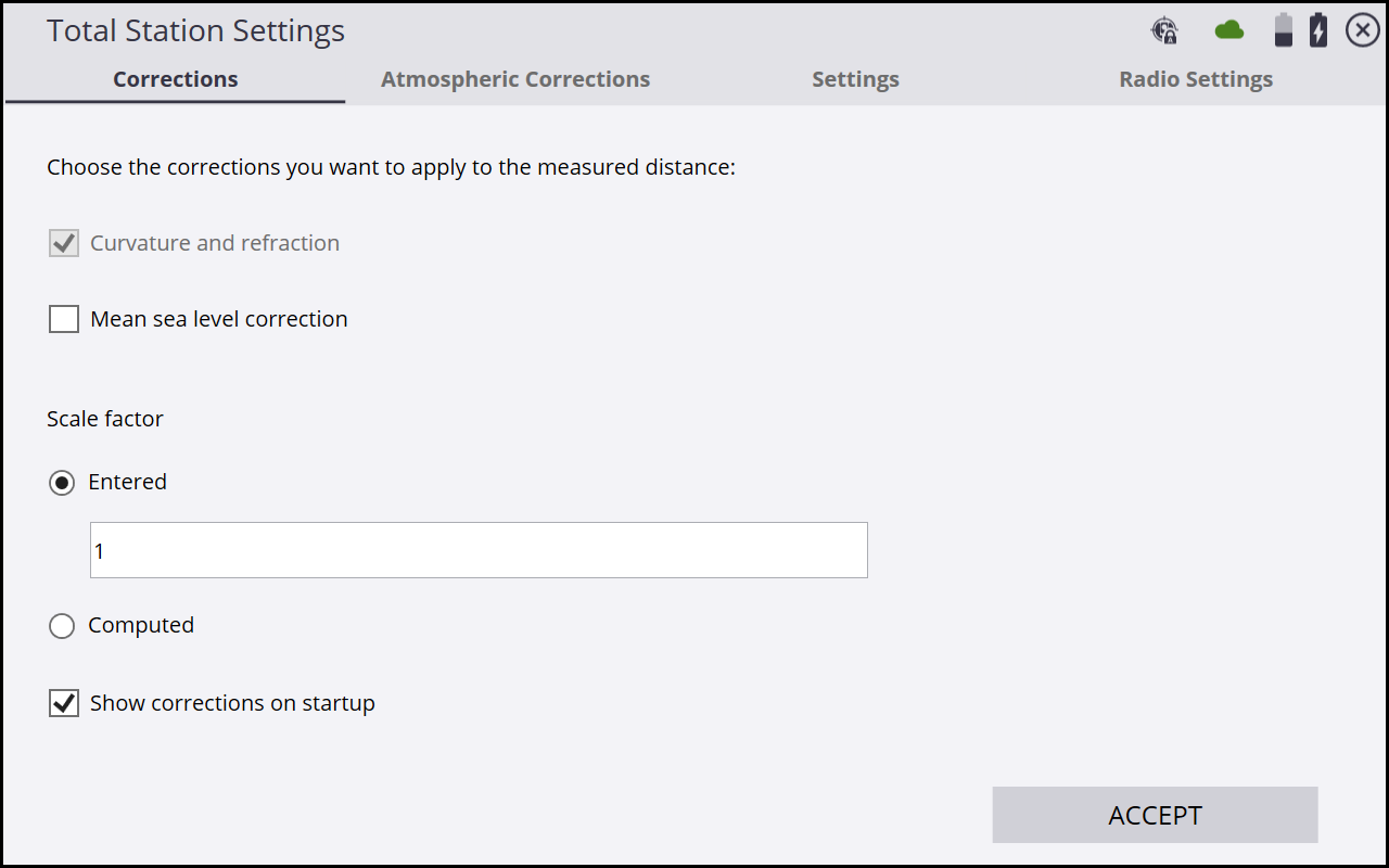
You can enter a fixed scale factor, set it to 1, or let the software compute a scale factor based on the site calibration measured with GNSS or imported from Trimble Business Center. The software uses the instrument coordinates resulting from the station establishment to calculate the correct scale factor for this instrument location in the selected coordinate system zone. Note that the Computed option calculated the scale factor at each individual station setup location.This may result in different scale factors being applied at each station.
Selecting the Mean sea level correction checkbox will account for the elevation of the instrument above mean sea level and apply the calculated elevation scale factor to the entered or computed scale factor, resulting in a combined scale factor being used. This checkbox should be selected after at least one GNSS point is measured or a site calibration has been performed, as the GNSS elevation data from the site calibration is used to set the project elevation in the mean sea level correction calculation. If you require a true "ground" scale factor of 1 to be used, then do not select the Mean sea level correction checkbox; instead select the Entered option and enter a value of 1. If it is select, then enter an elevation scale factor.
Once these options are set, values are locked to guarantee the consistency of the measurements in the project.
The scale factor used at each station setup can be reviewed in the TaskLog. Select Menu / Data Management / Log. The scale factor is also written to the instrument scratch pad to apply it for machine control operations with the Earthworks, GCS900, or AccuGrade grade control systems.
