Import TerraSync Files (.ssf)
Trimble Standard Storage Format files (.ssf) are used by Trimble GIS mapping field software such as Trimble TerraSync to log GNSS and feature data. You can import SSF files into TBC and perform post-processing of the GNSS data using the standard GNSS import/process workflow, including checking in raw receiver data, selecting a coordinate system, importing reference station data, and configuring and processing baselines to improve position and geometry for the imported features. The features can then be fully explored and edited as necessary before exporting to another system. This helps minimize the need for multiple post-processing software packages when working with TerraSync files.
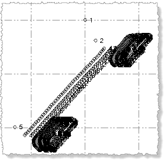
During import, points are imported as a continuous segment and are used to construct feature line and polygon geometry. After processing the trajectory using the Baseline Processor, you can review accuracy in the Baseline Processing Report before saving the trajectory in the project. The resulting points are contained on a project layer that has the same name as the SSF file. The layer is hidden by default. To view the points, select View Filter Manager in Views > View and check the check box for the SSF layer in the Layers list.
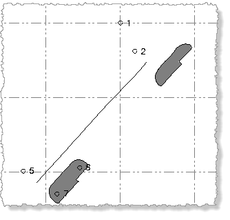
With the *.SSF layer hidden, the linework resulting from line and polygon feature points is displayed and the points used to construct the linework is hidden. Standalone SSF feature points are displayed as well (for example, points representing trees and lightpoles).
With the *.SSF layer displayed, the linework resulting from line and polygon feature points is displayed along with the points used to construct the linework.