Go to a Mobile Mapping Station Position
The Go to Run Position feature enables to display the panoramic images of the panoramic camera from the station position closest to the point picked on a run.
Note: The Go to Run Position can be used with all MX series mobile mapping system runs (excluding the MX7).
To go to a station position in the Run View by picking a point on a run:
- In the Project Explorer, select a run (or a set of runs).
- Select Toggle Trajectory in the context menu.
The Plan View shows the trajectory(ies) of the selected run(s), each with a specific color.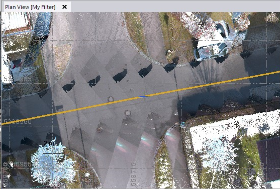
- Select Go to Run Position in Mobile Mapping > View. The Go to Run Position dialog opens.
- Pick a position on the displayed trajectory of the selected run.
The Run View tab opens and shows the images (panorama) of the Station closest to the position picked on the run.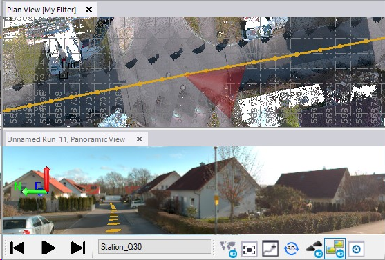
The Go To Run Position dialog shows the name of the run that has been picked as well as the timestamp.
