Capture Outlines from Measured or Scanned Points
The Capture Outline command enables you to quickly create building floor plans and other objects by selecting measured points or scanned points in your project. Simply select two points on each line in the Plan View and the command automatically connects those points using either a linestring or a polygon (your choice) to define the geometry for the outline.
Prequisites:
- Measured or scanned points
- See the Subscription Plans page. For a license matrix by command, see the License page in the TBC Community. Also see View and manage licensed features.
To capture an outline:
- Select Capture Outline in CAD > Lines > Linestring.
- In the Capture Outline command pane, optionally enter a name for the linestring/polygon in the Name (optional) field.
- Optionally, use the Feature (optional) drop-down list to select a line or polygon feature to apply to the Properties of the new linestring/polygon.
- Select a Line feature to apply that feature's attributes to the linestring. This list includes all line features included in the current project.
- Select a Polygon feature to create a polygon and apply that feature's attributes to the polygon. This list features all polygon features included in the current project.
- Optionally, use the Layer drop-down list to select a layer in which to place the outline. The layer defaults to 0.
- Select <<New Layer>> to create a new layer in which to place the outline.
- Optionally use the Elevation (optional) field to specify the elevation of the linestring/polygon. If no elevation is specified, the line is created with an elevation of the selected point.
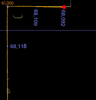
- Click the Coordinate field and then select a point along one of the lines in the point cloud.
- Click a second point along the same line.
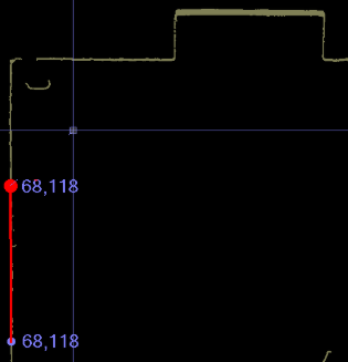
- Moving clockwise or counterclockwise, click a third and then a fourth point along the next intersecting line.
After you select each pair of points, the command calculates the location of the corner where the lines intersect.
Notes:
- You can select points in a clockwise or counterclockwise direction.
- If you select points on two parallel lines, the Capture Outline tool will not find the correct intersection.
- If you select three points along the same line, you'll see an error in the Coordinate field. - Continue selecting two points along the point cloud until you've completed each adjoining line.
If necessary, select Undo last coordinate to remove the last selected coordinate.
- When you are finished, do either of the following:
- Select Close Outline to close the polygon by intersecting the first and last lines.
If there is no intersection, the command closes the linestring by connecting the first and last points.
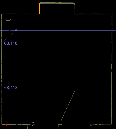
- Select Finish Outline to end at the final coordinate, which creates an open linestring or closes the polygon.
- Select Close Outline to close the polygon by intersecting the first and last lines.
- After selecting Close Outline or Finish Outline, you can create another linestring/polygon along a different point cloud.
- When you are done, select OK to store the current linestring/polygon and close the Capture Outline command pane.
