Adjustment and COGO
Efficiently reduce observations and perform cadastral survey workflows.
-
Finish CAD deliverables with options like COGO collections from existing linework, support for nested parcels, and ease of use enhancements.
-
Process static and kinematic GNSS observations and export GNSS vectors in National Geodetic Survey (NGS) *.gvx files consistent with varying third-party manufacturer hardware.
-
Re-engineered Kinematic GNSS processor provides substantially more precise and accurate results.
-
Compute and adjust traverse and level runs.
-
Translate field book data and notes into the Level Editor and Total Station Editor.
-
Complete least square corrections with mixed observations using Variance Groups and survey constraints in the Network Adjustment.
-
Input survey plans, compose legal descriptions, and compute parcel misclosures intuitively with the Create COGO routine.
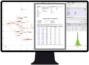
Apply a least-squares adjustment in a network adjustment.
Resources
Tutorials
Trimble Learn courses
