Aerial photogrammetry
Adjust, measure, and model from any drone, like leading UAV providers as DJI, Wingtra, Skydio, FreeFly and more.
-
Leverage streamlined aerial workflows by utilizing trajectory post-processing from a large variety of drones and easily drag + drop your data into TBC.
-
Extract points and geometry from station imagery, ortho images, and point cloud data using a variety of matching techniques.
-
Generate photo tie-points automatically and match ground control points (GCPs).
-
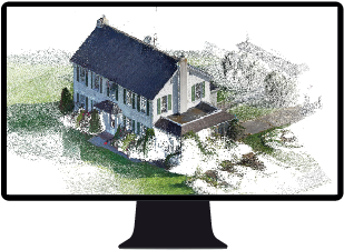
Create high-resolution point clouds, meshing, orthomosaics, and welevation raster digital surface models (DSMs) from Trimble or third-party UAVs.
-
Use Inpho UASMaster for additional processing, deliverables creation, and QA/QC options.
Adjust UAV data and create deliverables.
Resources
YouTube Playlist
Tutorials
Trimble Learn courses
Sample datasets
