Roads
New features
Road stakeout now supports cut/fill to BIM
You can now stake roads or strings with additional cut/fill computed from surfaces in an IFC model.
In the stakeout selection screen, enable the Cut/Fill to surface switch. In the Surface field instead of selecting the surface file from the current project folder, you can now select surfaces from BIM files. The Surface field indicates the number of surfaces you have selected in the map.
Additional surface deltas are available. To configure the deltas displayed during stakeout, tap Options and edit the deltas.
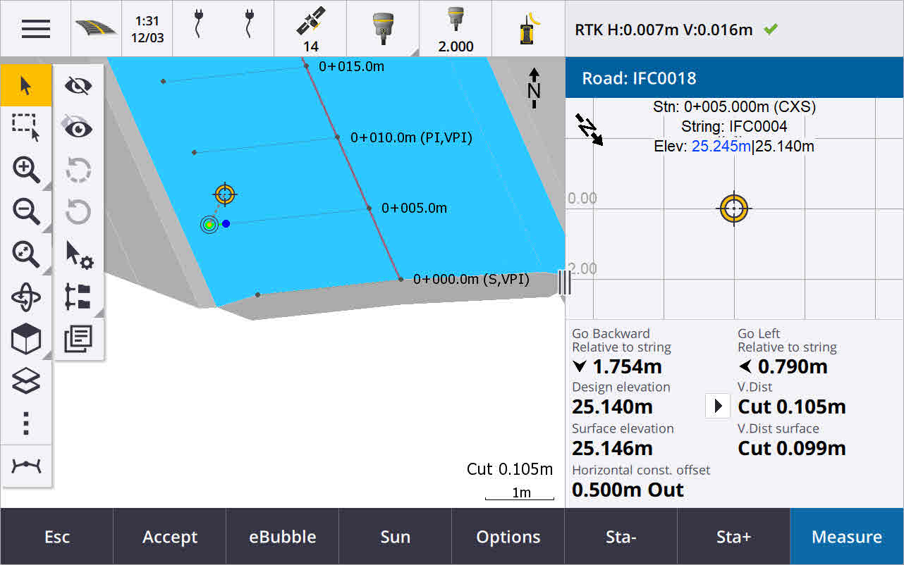
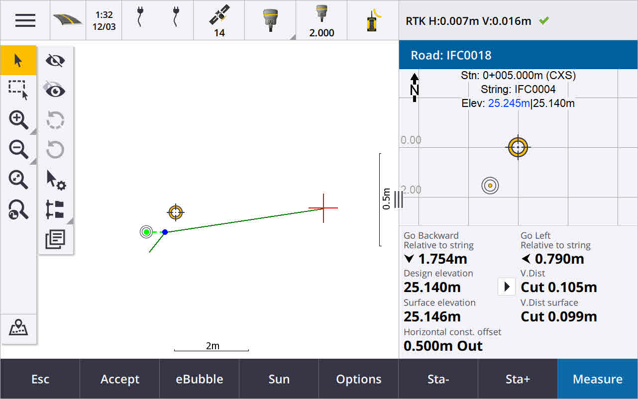
For more information, see the topic Stake positions relative to the primary string in the Trimble Access Help.
Enhancements
Perpendicular distance stake delta
When staking the surface between two strings, Trimble Access can now show the Perp Dist (perpendicular distance) delta to the surface between the two strings.
For more information, see the topic Stake the surface between two strings in the Trimble Access Help.
12da file enhancements
You can now review attribute information for items in a 12da file that have feature types associated with them from within the Trimble Access Roads app. To review attributes, in the map select the items from the 12da file and then tap Review. If you selected more than one item, select it from the list and tap Details.
When you use an item from a 12da file in a Cogo calculation, during stakeout, or to create a point in the job, Trimble Access now copies the attributes of the item from the file and stores them with the point, polyline or arc in the Trimble Access job.
Text that is not labels is now shown in the map when the 12da file is enabled in the Layer manager. Previously, only text that was classed as a label such as names, codes, and elevations for items in the file was shown. Now text such as file information or item information that has been entered directly in the file is shown.
Resolved issues
-
Road stakeout cut/fill: We have fixed an issue when staking a road, where the cut/fill stored in the job did not always equate to the design elevation minus the as-staked elevation. This was caused by an RTK position update happening in the instant between the time the cut/fill was calculated and the time the values were displayed on the Confirm staked deltas screen. The prior position's elevation was used to calculate the cut/fill, but the next position's elevation was displayed on the Confirm staked deltas screen and stored to the job. This resulted in the stored elevation being slightly different to what was used to calculate the cut/fill. This issue was more likely to occur if Auto store point was enabled. Typically during well converged RTK operation, the error was at the sub‑3mm (1/100th ft) level.
-
Strings and surfaces: We have fixed the following issues when using the Strings and surfaces workflow:
-
When staking using the Station on string method you can now select a station from the primary string.
-
When working from the menu in a GNSS survey, if you needed to set both the Antenna height and the Primary stationing string, tapping Accept now correctly takes you to the stakeout screen.
-
When the primary string was selected from an RXL file, the software was ignoring the start station and stationing method defined in the file.
-
When the primary string was selected from an RXL file, some deltas and string names were displayed as "?" when staking To two strings because the software failed to determine the direction to construct the string in relation to the alignment.
-
-
12da files: We have fixed issues loading 180 degree arcs in 12da files.
-
Hinge point: We have fixed the following issues with hinge positions:
-
The value shown in the H.Dist to Hinge point field changed if you switched between the plan and cross section view. The value shown in the cross section was correct, and this is the value that was stored.
-
If you changed the hinge position, the new side slope and cross section of the selected station were not updated in the plan view.
-
Now if you change the hinge position for the side slope during stakeout, after staking the new position the software returns to the side slope with the original position.
-
-
Application errors: We have fixed several issues that caused occasional application errors when using or closing the software. In particular:
-
When changing the stakeout method in cross section view.
-
