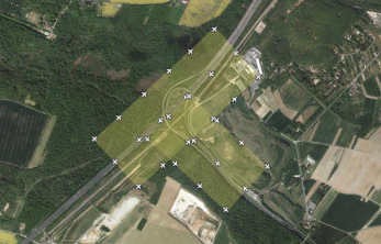
aerial photo station
An aerial photo station is created each time an aerial photo is taken during a flight mission. It defines a point and includes raw sensor values (orientation and tilt), coordinate data, and a photo image. The following image shows the aerial photo stations created for a flight mission. The station location and altitude determine the actual overlap between images taken from each station.