Export Mobile Mapping Cubical Images and Trajectory Files (.csv)
Mapillary is a collaborative street-level imagery platform from the Mapillary AB company, this means that any images captured anywhere by anyone, once combined, can be used for generating map data.
To export mobile mapping Mapillary files (.csv, .jpg):
- Select Export in Home > Data Exchange to display the Export command pane.
- Click the Mobile Mapping tab.
A list of available exporters displays.
- Select MX7 Export to Mapillary in the list.
- Click the Options button.
- And choose Select All from the drop-down list.
By default, the name in the File Name field is the name of the VCE project. The default location is the project folder.
- Optionally, in the File Name field, enter a different file name and/or file path.
- Optionally, blur the images (see Blur Exported Images).
- Click OK to export the data.
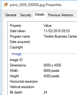
A set of panoramic image files is created. All reside in the folder you selected. Each panoramic image, named Pano, with a size of 8000 X 4000 pixels, is exported with the GPS Exif attributes. When you display its properties, you can see the following information i.e., its latitude, longitude and altitude, as well as when it has been acquired:
In addition to the panoramic image files, two CSV format files are created: one for the panoramic images and the other for the trajectory data.
