View Measure-to-Surface Point Data
You can import and process points recorded using the Measure to Surface command in Trimble Access, which simply measures the difference in distance from one or more points to a specified surface. This enables you to, for example, easily compare topo shots to an original ground surface model, or measure the clearance from the top of a tunnel to the road surface. If necessary, measure-to-surface points can be easily converted into normal survey points in your project.
To view measure-to-surface point data:
In the Project Explorer, measure-to-surface points and their associated observations are displayed as nested nodes beneath the Measure-to-Surface Points node.
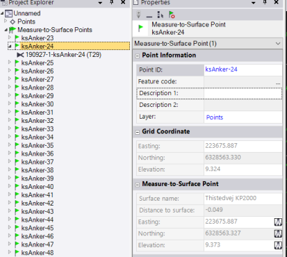
Right-click any measure-to-surface point node in the Project Explorer and select Properties to view complete information about the measure-to-surface point, including its related surface and distance to that surface.
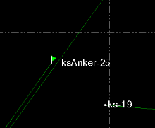
Measure-to-surface points are represented in the graphic views by measure-to-surface flag icons.
To convert a measure-to-surface point:
To convert a measure-to-surface point to a normal survey point, right-click it in the Project Explorer and select Convert Measure-to-Surface Point in the context menu.
