Georeferenced Image View
When you import one or more georeferenced images, they display in the Plan View based on the global or local coordinates specified in the georeference data.
To view properties for a georeferenced image, right-click the image in the Project Explorer or on a view tab and select Properties.
For instructions on moving the display of an image forward or backward relative to other images, see Move Images Forward and Backward.
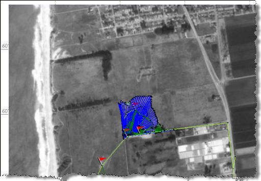
Survey data objects whose coordinates overlap with the coordinates of the georeferenced image are superimposed on top of the image (as shown below).
By default, georeferenced images are not selectable in the Plan View. To make georeferenced images selectable:
- Select View Filter Manager in Views > View.
- In the View Filter Manager pane, click the Advanced View Filter Settings icon.
- In the Advanced View Filter Settings dialog, check the Selectable check box for Georeferenced Image.
Note: Larger images require more memory and can limit the number of images that can be displayed. Smaller images do not display as clearly.
