Surfaces and volumes
Create, process, and deliver complex surface models from your mobile mapping data for field devices, machine control systems, and third-party export.
-
Create traditional, projected/vertical, and radial surfaces that dynamically update when surface members are modified.
-
Generate quick and accurate volume reports from surface comparisons, stockpile/depression, and corridor surfaces.
-
Compute gridded cut/fill surfaces and reports with customizable color mapping.
-
Specify contour lines and labels that update as the reference surface changes.
-
Drape objects onto surface, run point-to-surface comparisons, and view site balance factors in volume grid properties for a surface.
-
Create composite surfaces that reflect changes to their contributing surfaces as they are made.
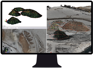
Compute precise surfaces and volume stockpile quantities.
Resources
Video/webinar link
Tutorials
Trimble Learn courses
Help topics
