GNSS Meter support
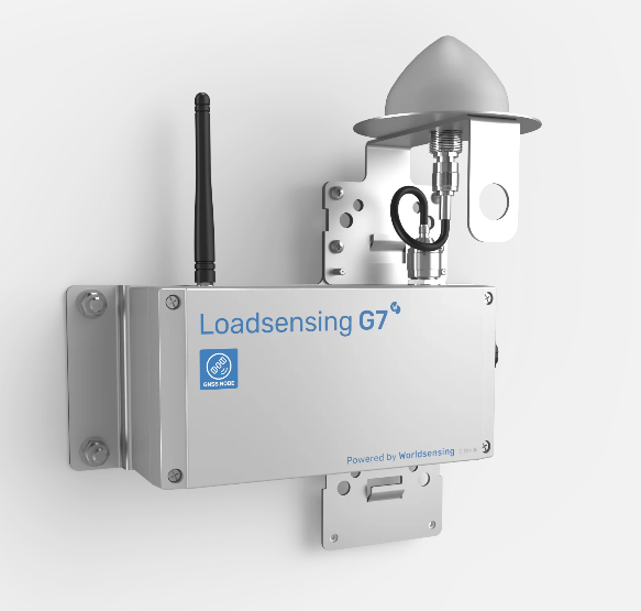
T4D supports the GNSS Meter powered by Worldsensing. GNSS Meter is a new tool designed for mining, construction, and infrastructure industries, tailored to help minimize the risks associated with land instability throughout a project's lifetime. It offers a user-friendly setup and intuitive interface, enabling rapid deployment of numerous sensors with minimal training, making it highly scalable. By leveraging wireless IoT technology, it minimizes infrastructure costs, eliminates the need for extensive cabling, and reduces maintenance expenses.
For more information about GNSS Meter working mode, visit the version 6.6 release notes or the GNSS Meter web section.
GNSS Meter
Data delivered by the GNSS Meter
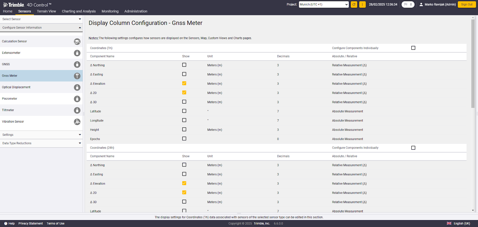
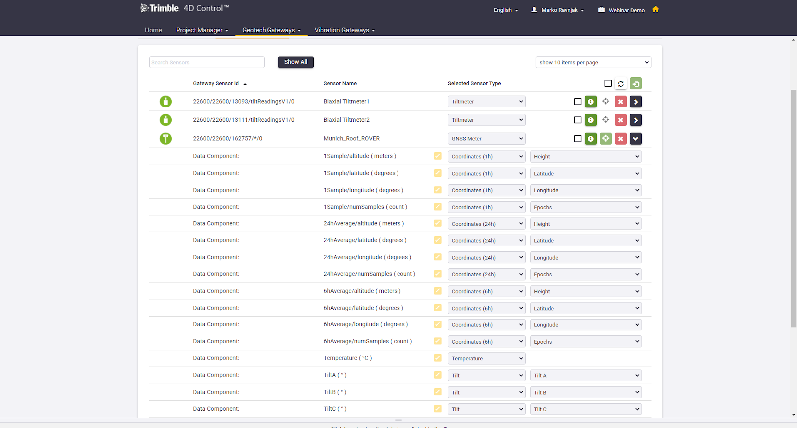
The GNSS Meter, as a multisensor device, delivers multiple data types but is treated as a single sensor in T4D. Data that can be directly read in T4D includes:
-
3D coordinates (WGS84 - Latitude, Longitude and Height) for the time windows of:
-
1-hour - the last available coordinate result derived from RTK fix measurements of that hour
-
6-hour - coordinate result derived from RTK fix measurements of the last 6 hours
-
24-hour average - coordinate result derived from RTK fix measurements of the last 24 hours
-
-
Tilt meter readings
-
Temperature data
-
Epochs (Samples)
-
1-hour - the number of RTK fixed measurements in the last hour
-
6-hours - the number of 1-hour results with RTK fixed measurements that are used for the 6-hour result calculation
-
24-hours - the number of 1-hour results with RTK fixed measurements that are used for the 24-hour result calculation
-
All coordinates share the same timestamp, as new readings also trigger the recalculation of the 6-hour and 24-hour averages. Since the device reports coordinates in WGS84 by default, a coordinate transformation to grid coordinates is performed in T4D, ensuring coordinate system consistency within the project.
Available GNSS Meter data during T4D import
-
A coordinate system must be defined to use the GNSS Meter with T4D. The default coordinate system is not supported.
-
The GNSS Meter also delivers GNSS statistical data to the gateway. This data is not available in T4D but can be accessed in CMT Edge if necessary.
-
Configure the GNSS Meter to obtain information on displacements as part of the Engineering Units workflow on CMT Edge. This data is currently not supported in T4D.
-
The user must manually input the Base unit's coordinates after adding the sensor to T4D. This is done within the 'Location' section of the 'Edit Sensor' workflow.
-
GNSS Meter data types do not currently support trend calculations or velocities.
The default enabled data types are ∆2D and ∆Elevation once the data is available in T4D. This can be changed in the Configure Sensor Information window if needed, before leveraging other T4D functions (charting, analysis, alarms etc.)