Using the Apps: reporting, measurement, and design tools
SiteVision provides a number of
All measurements and design data are recorded in a .csv, with all of the positions, angles, distances, accuracy estimates, etc., and are associated with the model loaded at the time these measurements or designs are made.
NOTE –
-
The measured data and designs using the BCF Topics, Plane, and Profile apps are visible only for the current session and model loaded. Any placed PDFs, or measurements using the Points, Grade & Distance, Lines & Area, Volume, and Cut-Fill apps are preserved from earlier SiteVision sessions; these are stored under a Prior User Measurements layer.
-
You cannot use the measurement and design tools if you have 2D model data loaded.
-
If the orientation status is red, the measurement and design tools are disabled for all measurement modes except GNSS measurement mode.
Before you start using the apps:
-
See About measurement modes for more information.
-
For information on using each of the apps, see the links in Accessing the apps, below.
When you record measurements ![]() then tap the required layer(s) to hide or display them. See Viewing a model for more information on layers.
then tap the required layer(s) to hide or display them. See Viewing a model for more information on layers.
Accessing the apps
To access the apps, tap or swipe-up the App icon ![]() (center of the main screen). The Apps carousel displays the available apps:
(center of the main screen). The Apps carousel displays the available apps:


 Scan
Scan


TIP – When you tap ![]() , it changes to
, it changes to ![]() . Tap
. Tap ![]() to see a brief description of the selected app. To see a brief description of other apps, tap the app icon on the carousel, or tap Previous or Next.
to see a brief description of the selected app. To see a brief description of other apps, tap the app icon on the carousel, or tap Previous or Next.
To use one of the apps, tap its icon from the carousel; it becomes the active app and is displayed in the center of the screen, replacing the ![]() icon.
icon.
TIP – To select a different app, tap-hold or swipe upwards on the current active icon. All the available apps are redisplayed on the Apps carousel.
Each of the apps can be used in some or all of the following measurement modes:
-
 GNSS
GNSS -
measurements to the Real World, using:
-
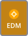 EDM (supported only on the HPS2 handle and the SiteVision Integrated Position System)
 -
 LiDAR (supported devices only)
 -
 Camera
-
-
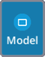 Model measurements to the Digital Model
See About measurement modes for more information.
The active measurement mode is indicated on the active app icon, as a border around the button. For example, the Measure Point  app using LiDAR based measurements will show as
 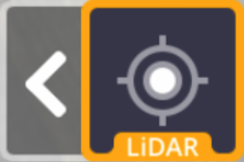 .
.
To select a different measurement mode tap the arrow to the left of the active app icon. The available modes (shown here with Measure Point + GNSS as the active app) show as:
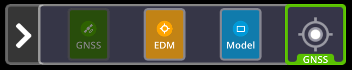
Tap the required measurement mode; the active app icon is updated showing the new measurement mode.
