View Photogrammetry Data
To view photogrammetry data in the Project Explorer:
- Individual photogrammetry Point nodes
 are displayed nested beneath the parent Points node
  the same as normal Point nodes. Nested beneath each photogrammetry Point node are two or more photogrammetry Observation nodes
  . To view properties for a photogrammetry point or observation, right-click the node and select Properties. To view the Point Derivation Report for a photogrammetry point, which includes photogrammetry intersection information, right-click the Point node and select Point Derivation Report.
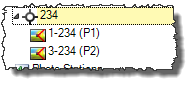
- Stations that include referenced photo images are represented by individual Station nodes
 nested beneath the parent Photo Stations node
  . If the station includes photogrammetry observations (measurements), photogrammetry Observation nodes are nested beneath the Station node. To view properties for a photo station or photogrammetry observation, right-click the node and select Properties.
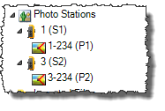
- Referenced photo images captured from stations are represented by Image nodes
 nested beneath the Images parent node
  . To view the photo image on a Station View tab or in an external viewer, or to view properties for the image, right click the node and select the appropriate option.
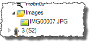
To view photogrammetry data in the Plan View:
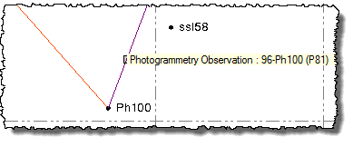
- To view properties for a photogrammetry point, select the point in the view, right-click, and select Properties. To view the Point Derivation Report for the point, which includes photogrammetry intersection information, right-click and select Point Derivation Report.
- To view properties for a photogrammetry observation, select the observation line in the view, right-click, and select Properties.
Note: If the Measure Photo Point command pane is open, the line-of-sight rays for a photogrammetry point are displayed instead of the observation lines.
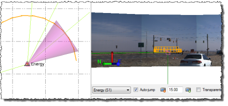
- You can display on the Plan View tab a graphical indicator of the field of vision for each station view displayed on an open Station View tab. As you change the field of vision on the Station View tab (for example, zoom in or out, pan left or right, or tilt up or down), the corresponding indicator on the Plan View tab reflects your changes. Select Options in the Quick Access Toolbar. Then select Photogrammetry to turn the field of vision indicator on and off, and select how the indicator is displayed. See Photogrammetry Options for more information.
Note: Referenced images that were imported from an aerial survey also display in the Plan View,along with their associated aerial photo stations. For more information, see View Aerial Photo Station Data.
To view photogrammetry data in the Photo Point Spreadsheet
- To view all photogrammety point and observation data in a spreadsheet format, do one of the following:
- Select Photo Point Spreadsheet in Home > Data or in Photogrammetry > Data.
- Click the Photo Point Spreadsheet icon
 located in the toolbar at the top of the Measure Photo Point command pane.
